Devon · TQ6
Drone surveys in Dartmouth, flown by the surveyor who writes them
Just over an hour from Exeter. Streets steep enough to become stairs, jettied merchant houses, and roofs that discharge onto their neighbours.
A town where streets become stairs
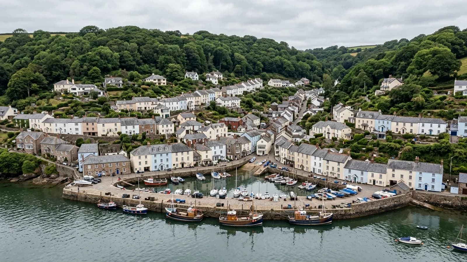
Dartmouth is built on ground so steep that some streets turn into flights of steps, stacked up the west bank of the Dart above a deep water port. It is a little over an hour from Exeter, usually via Totnes, and it is a place where conventional roof access is close to impractical on a large share of the buildings.
The steep stacking has a direct consequence for the roofs: one building's roof frequently discharges towards its neighbour, or onto a wall, or into a gutter shared between two owners. Rainwater disposal here is a chain rather than a series of independent systems, and a blockage part way up the hill becomes somebody else's damp wall further down.
That is a difficult thing to establish from the ground and a straightforward thing to photograph from the air. Following the water is often the most useful part of a Dartmouth survey.
Exceptional historic fabric
The stock around Bayards Cove and the Butterwalk includes timber framed and jettied merchant houses of a quality that is rare anywhere in England, with Georgian and Victorian terraces climbing the hill behind and the Britannia Royal Naval College dominating the skyline above.
Timber framed and jettied buildings put roof loads and rainwater in awkward places by design. Jetties throw water clear of the wall below and then somewhere else entirely; roof planes meet at angles that were set by the plot rather than by a drawing; and generations of alteration have left lead lined valleys and gutters that were solutions to problems nobody now remembers.
Slate hanging appears here as it does elsewhere on this coast, used on the elevations that take the driving rain. From the air it reads well: individual slipped or missing slates on a hung elevation show clearly, and so does the difference between an original run and a patch.
Sheltered, and damp with it
The river mouth shelters the town from the worst of the open sea, so this is not a wind exposure story in the way that Dawlish or Exmouth are. It is a damp story. Sheltered, wooded, steep sided and beside a large body of water is the recipe for slow drying, and organic growth on shaded slate is persistent.
For a listed building that matters because the remedies are constrained. Getting to the moss is the problem, not knowing it is there, and a photographic record of exactly where it is and how thick it has got lets a conservation minded contractor plan the minimum intervention rather than the maximum.
The river, and flying near it
The Dart is the middle of the town's geography and there is traffic on it. The castle sits at the mouth and the Naval College above, and between them the airspace and the ground use around the town need looking at properly before a flight rather than on arrival.
None of that makes Dartmouth difficult to survey. It makes it a place where the desk work before the visit is worth doing carefully, which is the case for the whole of this list but more so here than in most.
Behind the survey
What Dartmouth clients are actually buying
Registered with the CAA
A registered operator with both an Operator ID and a Flyer ID. The Operator ID is the one that has to be displayed on the aircraft, and it is the number a client or an insurer asks for.
A2 Certificate of Competency
The A2 CofC is the theory and self-practical qualification that sits above the basic Flyer ID test. There is no GVC, which is stated here rather than left out, because it changes how some sites have to be planned.
Insured with Coverdrone
Commercial cover through Coverdrone, one of the specialist drone insurers. A copy of the certificate goes out on request before a booking, not after it.
DJI Mavic 4 Pro
The main survey aircraft. A 100 megapixel Hasselblad camera and 6K video, which is what lets a photograph of a ridge from twenty metres away still show an open mortar joint.
DJI Mavic 2 Enterprise Advanced
The thermal aircraft. A 640 by 512 radiometric thermal camera alongside the visual one, so a heat pattern can be read against the picture of the same elevation.
Construction background
The surveying came after years of contracting, so the report is written by somebody who has stood on the scaffold as well as flown over it, and who knows which faults matter and which are cosmetic.
Written report within 48 hours
A process commitment, not a sales promise. The flight is the short part of the job; the report is where the time goes, and it lands within two days of the visit.
No scaffolding, no ladders
Nothing leans on the building and nobody goes up it. That removes the access cost, the permit paperwork and the working-at-height risk from the survey itself.
Nearby
Also covered around Dartmouth
See the credentials
Talk to a surveyor in Dartmouth
Send the address and what is worrying you. Sam Hembury will come back with a fixed price and the next slot that suits the weather.