Drone Surveyors
Mapping, records and search
Everything flown over an area rather than a building: mapping runs, dated site records, aerial photography, and searching open ground when something is missing.
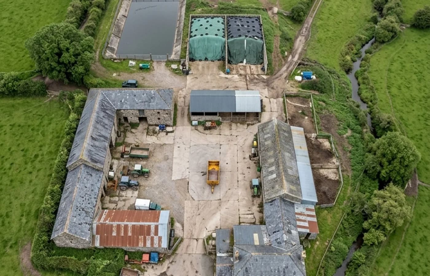
The third strand covers the jobs where the subject is a piece of ground rather than a structure. A farm and its yard, a development site part way through, an estate, a boundary somebody is arguing about, or a stretch of moor with a dog on it.
These are grouped together because they share a method: a planned flight over an area at a consistent height, producing either a set of overlapping frames that can be assembled into one image, or a dated record that means something when compared with the next one.
What they are not is a land surveyor's plan. Where a job needs measured accuracy tied to ground control, that is a different discipline with different equipment, and the sensible answer is to say so rather than to sell a photograph as a survey drawing.
What is included
- A planned run at consistent height and overlap over the area agreed
- A dated set of frames that can be compared directly with a later flight
- Oblique frames as well as vertical ones, because a bank or a wall reads better from an angle
- Aerial photography for marketing or records where that is what is wanted
- Search flights over open ground, flown with the thermal camera where conditions suit it
- Full resolution imagery handed over, with nothing held back
Dated records, and why the date is the point
A single aerial photograph of a site is mildly interesting. Two of the same site, flown the same way six months apart, are evidence. That is what makes this worth doing on a development, a quarry, a farm carrying out works, or a property where a boundary or an encroachment is likely to be argued about later.
For that to hold, the flights have to be comparable: the same height, the same pattern, the same coverage, and a note of the date and conditions. A record put together from whatever was flown on the day is worth much less when somebody asks what changed.
Where measured accuracy comes from
Photographs taken from an aircraft can be assembled into an image that looks like a map, and for a great many purposes that is exactly what somebody needs. What it does not carry on its own is survey grade absolute accuracy, which comes from ground control set and measured by a land surveyor.
So no accuracy figure appears here. If a job needs one, the right answer is a land surveyor, or a land surveyor's control combined with the aerial capture, and that gets said at the enquiry stage rather than after an invoice.
Search flights
Searching open ground for a missing animal is a real use of the thermal camera, and it is flown where the ground, the conditions and the law allow it. Cool, still, early or late is when it works; the middle of a warm day is when it does not, because everything on the ground is the same temperature as everything else.
For a missing person, the answer is the police and the coastguard, in that order and immediately. Nothing on this site is an emergency service and no drone should be delaying a 999 call.
On the day
How a mapping and records runs
- Step 1
Define the area
A boundary on a map, a postcode and a description, or a walk round on the day. The area decides the flight time and therefore the price.
- Step 2
Check what is under and around it
Airspace, neighbouring property, livestock, footpaths and anyone likely to be on the ground during the flight.
- Step 3
Fly the pattern
A planned run rather than a wander, so the frames overlap consistently and the set can be repeated the same way in six months.
- Step 4
Add the obliques
Angled frames of the buildings, the accesses and anything with height, which a straight-down run flattens out of existence.
- Step 5
Hand it over
Imagery and a short written record of what was flown, when, and in what conditions, so the set is worth something as a comparison later.
Behind the work
Kit, cover and qualifications
Registered with the CAA
A registered operator with both an Operator ID and a Flyer ID. The Operator ID is the one that has to be displayed on the aircraft, and it is the number a client or an insurer asks for.
A2 Certificate of Competency
The A2 CofC is the theory and self-practical qualification that sits above the basic Flyer ID test. There is no GVC, which is stated here rather than left out, because it changes how some sites have to be planned.
Insured with Coverdrone
Commercial cover through Coverdrone, one of the specialist drone insurers. A copy of the certificate goes out on request before a booking, not after it.
DJI Mavic 4 Pro
The main survey aircraft. A 100 megapixel Hasselblad camera and 6K video, which is what lets a photograph of a ridge from twenty metres away still show an open mortar joint.
DJI Mavic 2 Enterprise Advanced
The thermal aircraft. A 640 by 512 radiometric thermal camera alongside the visual one, so a heat pattern can be read against the picture of the same elevation.
Construction background
The surveying came after years of contracting, so the report is written by somebody who has stood on the scaffold as well as flown over it, and who knows which faults matter and which are cosmetic.
Written report within 48 hours
A process commitment, not a sales promise. The flight is the short part of the job; the report is where the time goes, and it lands within two days of the visit.
No scaffolding, no ladders
Nothing leans on the building and nobody goes up it. That removes the access cost, the permit paperwork and the working-at-height risk from the survey itself.
Mapping and records
Mapping, records and search questions
- Can you produce a plan I can give to an architect?
- You get imagery, dated and covering the area agreed, which an architect can work from as context. A measured plan is a land surveyor's job and needs their control points, and the site page on how a job runs explains where that line falls.
- How big an area can you cover in one visit?
- It depends on the height flown and the detail wanted. A farmyard and its immediate fields is a straightforward morning. A whole estate is a conversation about how much detail is worth paying for.
- Do you fly over other people's land to get the shot?
- Flights are planned around what is under them, and the aircraft is kept over ground where it should be. Where a shot would need to be taken from over a neighbour's property, that gets raised rather than quietly done.
- Will you search for a missing dog?
- Yes, over open ground, where conditions suit the thermal camera and where flying is lawful. It is worth a phone call first because timing matters more than almost anything else, and there are nights when it will not work at all.
Where
Mapping, records and search across the South West
Also on this site
See the credentials
Talk to a surveyor with Drone Surveyors
Tell us the address and what you need looking at. Sam Hembury will come back with a fixed price and the next available slot.