Devon · EX3
Drone surveys in Topsham, flown by the surveyor who writes them
Ten minutes from Exeter. A dense listed core on the Exe estuary, where salt air and hard driven rain do the damage rather than neglect.
Close enough for a single stack
Topsham is about ten minutes from the base, which makes it one of the few places where a very small job is straightforward to justify on its own. One chimney, one valley, one section of parapet: worth flying, worth quoting, no need to wait for something else in the area.
It is also a town where the survey is often wanted quickly, because a large share of the building stock is listed and a great deal of it is in the hands of owners who want to know what is happening up there before a builder starts guessing.
A listed town with no way to see its own roofs
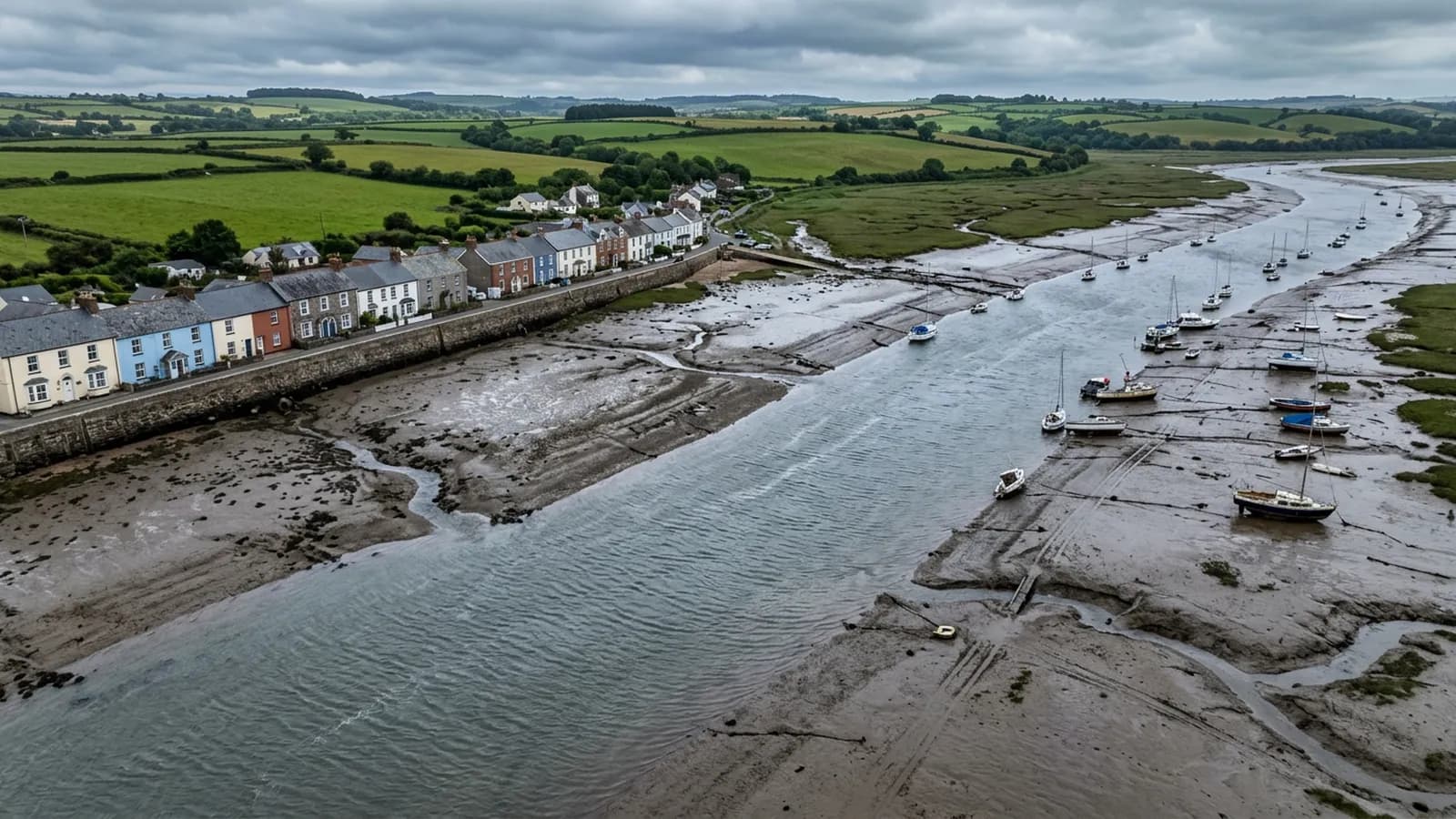
The historic core is a dense run of merchant houses and cottages, many of them listed, built right up to the water and right up to each other. Behind them are Victorian and Edwardian streets and then modern infill towards the Exeter road, but it is the old core that generates the survey work.
The problem is geometry. Buildings this tight have shared valleys, party wall abutments, hidden gutters behind Dutch influenced gables, and lead and zinc detailing that has been patched by several generations of different trades. None of it is visible from the street and most of it is not visible from a neighbour's window either. Scaffolding a listed frontage to find out whether a lead flat has failed is an expensive way to ask a question.
The Dutch influenced gables are a specific case worth naming. A gable of that shape has more edge, more upstand and more lead per square metre than a plain one, and every one of those junctions is a place water can be persuaded to go the wrong way. From the air they photograph beautifully and read clearly.
Estuary air, and what it does to metal
The estuary is damp and salt laden the whole year round, not just in storms, and the town takes the full run of wind up the water from the south. That combination drives rain hard against south west facing slopes and puts salt on every fixing.
In practice the fixings go before the coverings. Slate here is often perfectly serviceable while the nails holding it have rusted to nothing, which is why a slate that has slipped in Topsham is a signal to look at the whole slope rather than an isolated repair. Clay pantile behaves differently again: it is a big unit with a shallow lap, and hard driven rain from the south west finds its way under a pantile that a gentler climate would never trouble.
Lead and zinc detailing corrodes and creeps in these conditions, and both show well from above. Splits at the fold, lifted welts, and lead that has crept down a valley far enough to open a gap at the head are all photographable at a distance that makes them readable in a report.
Flying beside the water
Topsham has open water, salt marsh and mudflats on three sides, and a lot of birds. The wind coming up the estuary arrives in gusts rather than as a steady flow, and it changes character as it comes round buildings on the Strand. A flight here gets planned with more margin than the same job would need inland.
The Goat Walk, Bowling Green Marsh and the quay are all places where the ground next to a property is public and busy in good weather. Where an address backs onto one of those, the sensible answer is often an early start rather than a clever flight plan.
Behind the survey
What Topsham clients are actually buying
Registered with the CAA
A registered operator with both an Operator ID and a Flyer ID. The Operator ID is the one that has to be displayed on the aircraft, and it is the number a client or an insurer asks for.
A2 Certificate of Competency
The A2 CofC is the theory and self-practical qualification that sits above the basic Flyer ID test. There is no GVC, which is stated here rather than left out, because it changes how some sites have to be planned.
Insured with Coverdrone
Commercial cover through Coverdrone, one of the specialist drone insurers. A copy of the certificate goes out on request before a booking, not after it.
DJI Mavic 4 Pro
The main survey aircraft. A 100 megapixel Hasselblad camera and 6K video, which is what lets a photograph of a ridge from twenty metres away still show an open mortar joint.
DJI Mavic 2 Enterprise Advanced
The thermal aircraft. A 640 by 512 radiometric thermal camera alongside the visual one, so a heat pattern can be read against the picture of the same elevation.
Construction background
The surveying came after years of contracting, so the report is written by somebody who has stood on the scaffold as well as flown over it, and who knows which faults matter and which are cosmetic.
Written report within 48 hours
A process commitment, not a sales promise. The flight is the short part of the job; the report is where the time goes, and it lands within two days of the visit.
No scaffolding, no ladders
Nothing leans on the building and nobody goes up it. That removes the access cost, the permit paperwork and the working-at-height risk from the survey itself.
Nearby
Also covered around Topsham
- ExeterThe base town, ten minutes away. The constraint in Exeter is other people rather than distance: dense roofscapes, student blocks, city airspace.
- ExmouthTwenty minutes from Exeter and the most exposed town on the list: two miles of open front, unbroken salt wind, and uplift at ridge and verge.
- Budleigh SaltertonAround twenty five minutes from Exeter. Substantial detached houses in generous plots, long held and lightly altered, with thatch on the outskirts.
See the credentials
Talk to a surveyor in Topsham
Send the address and what is worrying you. Sam Hembury will come back with a fixed price and the next slot that suits the weather.