Devon · EX11
Drone surveys in Ottery St Mary, flown by the surveyor who writes them
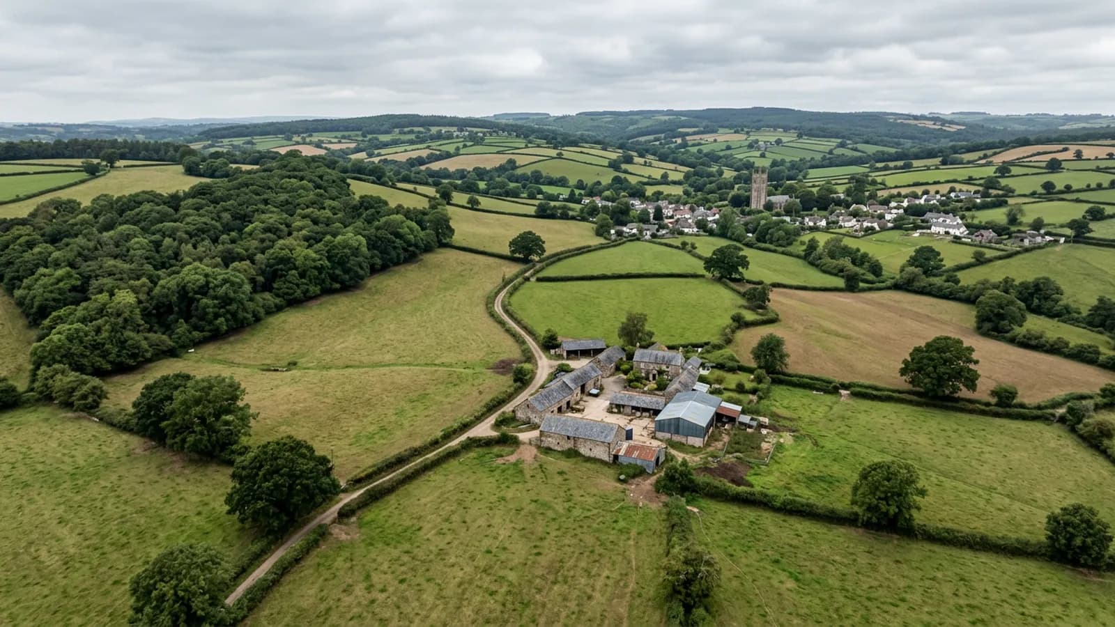
About half an hour from Exeter. An inland valley town where mist and damp let moss establish fast on shaded slopes, with cob and thatch in the lanes.
Inland, sheltered, and quietly damp
Ottery St Mary is around half an hour from Exeter, sitting on gently rolling ground in the Otter valley between the Blackdown Hills and the coast eight miles south. It is inland and reasonably sheltered, which sounds like good news for a roof and only partly is.
The valley floor holds mist and damp, and that lets moss and lichen establish quickly on shaded slopes and in valleys. Shelter from wind and persistent damp is the combination that produces the thickest organic growth, because nothing ever scours the roof clean and nothing ever dries it out.
Why moss is a structural finding here
On an exposed coastal roof, moss barely gets a foothold. In a sheltered damp valley it becomes a layer, and a layer of moss does three things. It holds water against the covering. It lifts the tails of slates and tiles slightly, which lets wind get underneath. And when it comes away in a storm it goes into the gutters and the valleys and blocks them.
So on an Ottery survey the growth is photographed and assessed rather than noted in passing: how thick, where, whether it is in the valleys or only on the open slopes, and whether it has started to lift anything. The answer determines whether the recommendation is cleaning, cleaning and re-fixing, or leaving it alone, and those are very different bills.
The coverings are natural slate, clay plain tile, thatch and concrete tile on the modern estates. Thatch in a damp valley has the same ridge problem as Crediton, for the same reason.
The historic core and the lanes
The compact centre around St Mary's Church has Georgian and Victorian frontages, and there are cob and thatch survivals in the surrounding lanes with post-war and modern estates spreading north and west.
St Mary's itself is a very substantial parish church, and church roofs are among the most rewarding aerial surveys there are: large areas of lead, parapet gutters, tower and turret details, and a maintenance budget that has to be argued for. A photographic record that shows exactly what has failed and what has not is worth a great deal to a parochial church council trying to prioritise.
Cadhay House and the Tumbling Weir are the other local landmarks, and cob buildings in the lanes bring their own consideration: cob depends absolutely on staying dry, so the roof over it and the rainwater goods on it are doing structural work rather than merely keeping the weather out.
An easy town to fly in
Gently rolling ground, reasonable shelter and a compact centre make this one of the more straightforward towns to plan a flight in. There is no significant wind problem, no coastal salt, and no steep terrain to complicate a launch point.
What it does need is the right conditions for looking at growth and damp: after rain rather than after a fortnight of sun, and in the colder half of the year rather than in high summer, so that what shows in the imagery is representative of how the roof spends most of its life.
Behind the survey
What Ottery St Mary clients are actually buying
Registered with the CAA
A registered operator with both an Operator ID and a Flyer ID. The Operator ID is the one that has to be displayed on the aircraft, and it is the number a client or an insurer asks for.
A2 Certificate of Competency
The A2 CofC is the theory and self-practical qualification that sits above the basic Flyer ID test. There is no GVC, which is stated here rather than left out, because it changes how some sites have to be planned.
Insured with Coverdrone
Commercial cover through Coverdrone, one of the specialist drone insurers. A copy of the certificate goes out on request before a booking, not after it.
DJI Mavic 4 Pro
The main survey aircraft. A 100 megapixel Hasselblad camera and 6K video, which is what lets a photograph of a ridge from twenty metres away still show an open mortar joint.
DJI Mavic 2 Enterprise Advanced
The thermal aircraft. A 640 by 512 radiometric thermal camera alongside the visual one, so a heat pattern can be read against the picture of the same elevation.
Construction background
The surveying came after years of contracting, so the report is written by somebody who has stood on the scaffold as well as flown over it, and who knows which faults matter and which are cosmetic.
Written report within 48 hours
A process commitment, not a sales promise. The flight is the short part of the job; the report is where the time goes, and it lands within two days of the visit.
No scaffolding, no ladders
Nothing leans on the building and nobody goes up it. That removes the access cost, the permit paperwork and the working-at-height risk from the survey itself.
Nearby
Also covered around Ottery St Mary
- HonitonThirty five minutes from Exeter. A uniform Georgian high street rebuilt after fires, in a valley whose sitting fog keeps roofs damp all winter.
- SidmouthAbout forty minutes from Exeter. A Regency town in a steep valley, where hills either side funnel wind and make the air round chimneys turbulent.
- CullomptonTwenty five minutes up the M5. A Culm valley town of medieval fabric, thatch and modern estates, on ground that holds damp and frost.
- ExeterThe base town, ten minutes away. The constraint in Exeter is other people rather than distance: dense roofscapes, student blocks, city airspace.
See the credentials
Talk to a surveyor in Ottery St Mary
Send the address and what is worrying you. Sam Hembury will come back with a fixed price and the next slot that suits the weather.