Devon · EX17
Drone surveys in Crediton, flown by the surveyor who writes them
Fifteen minutes from Exeter. Cob and thatch in the lanes, Devon slate and stone tile in the town, and a valley that is hard on thatch ridges.
Fifteen minutes up the Creedy
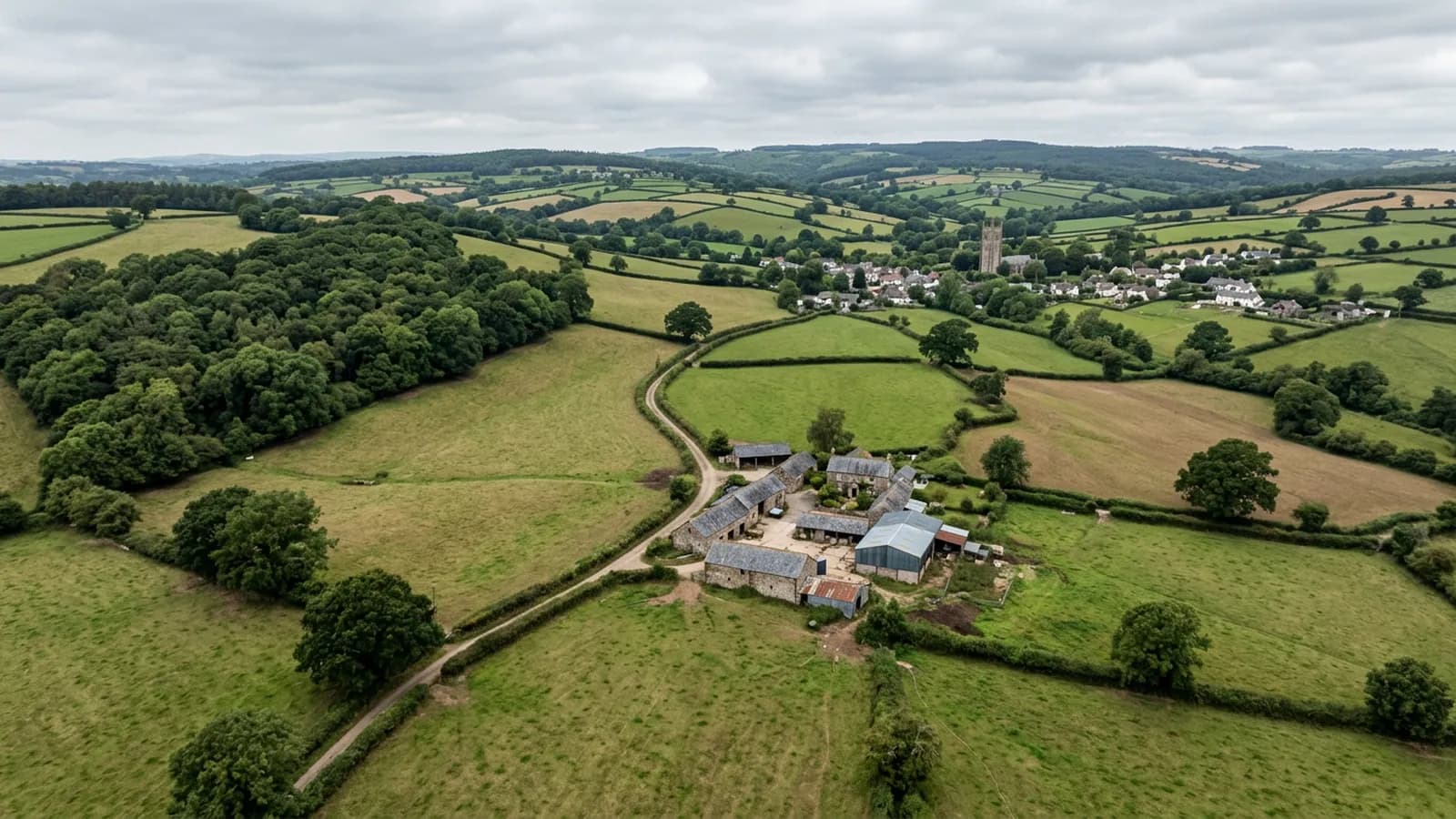
Crediton is about fifteen minutes from Exeter, which makes it one of the easiest towns on this list to get to and one where a single small job is worth flying on its own. The Creedy valley runs between steep red sandstone hills and the surrounding farmland is some of the most productive in Devon.
The work here divides between the long Georgian and Victorian high street, the cob and thatch cottages in the surrounding lanes, and the farmhouses and barn conversions across the rural hinterland. Three quite different building traditions inside twenty minutes of each other.
Thatch, and the ridge that goes first
Thatch is a real presence here and it is one of the coverings that benefits most from being looked at from above. A thatched roof is assessed on the depth of the coat, the condition of the ridge, the wear around chimneys and dormers, the netting, and the fixings at the eaves. From the ground you can see the eaves and guess at the rest.
The ridge goes first, and in this valley it goes faster than it would on higher ground. The valley traps damp air, which is hard on thatch ridges, and a ridge that is breaking down lets water into the coat beneath it where it does real damage rather than sitting on top where it does none.
An aerial inspection does not replace a master thatcher and the report says as much. What it does is give an owner a dated photographic record of coat and ridge condition, which is worth having when the quotes come in and worth more again the following year when comparing.
Devon slate and stone tile
The town and the surrounding buildings carry Devon slate and stone tile alongside the thatch, both of which are heavy, both of which are laid in diminishing courses on older roofs, and both of which fail at the fixings rather than in the material.
Stone tile in particular is worth close photography. The units are heavy enough that a failed peg or nail is a safety matter, not just a leak, and the pattern of individual units that have slipped tells you how far the fixing failure has spread. That is legible in a high resolution frame from a few metres away and is not legible from the lane.
Corrugated metal turns up on the agricultural buildings, as everywhere in this part of the county, with the same fixings and lap questions as anywhere else.
Open to the west, damp in the bottom
The valley is open to Atlantic weather from the west with little shelter, and it traps damp air in the bottom. North facing slate stays green and thatch ridges stay wet, which is the specific local combination that shapes what a survey finds.
Holy Cross Church and Downes House are the landmarks, and the productive farmland of the Creedy valley is what surrounds them. Farm work here is much the same as at South Molton: a single flight over a holding covering house, barns and yard together, planned around livestock and around whatever is being done on the ground that week.
Behind the survey
What Crediton clients are actually buying
Registered with the CAA
A registered operator with both an Operator ID and a Flyer ID. The Operator ID is the one that has to be displayed on the aircraft, and it is the number a client or an insurer asks for.
A2 Certificate of Competency
The A2 CofC is the theory and self-practical qualification that sits above the basic Flyer ID test. There is no GVC, which is stated here rather than left out, because it changes how some sites have to be planned.
Insured with Coverdrone
Commercial cover through Coverdrone, one of the specialist drone insurers. A copy of the certificate goes out on request before a booking, not after it.
DJI Mavic 4 Pro
The main survey aircraft. A 100 megapixel Hasselblad camera and 6K video, which is what lets a photograph of a ridge from twenty metres away still show an open mortar joint.
DJI Mavic 2 Enterprise Advanced
The thermal aircraft. A 640 by 512 radiometric thermal camera alongside the visual one, so a heat pattern can be read against the picture of the same elevation.
Construction background
The surveying came after years of contracting, so the report is written by somebody who has stood on the scaffold as well as flown over it, and who knows which faults matter and which are cosmetic.
Written report within 48 hours
A process commitment, not a sales promise. The flight is the short part of the job; the report is where the time goes, and it lands within two days of the visit.
No scaffolding, no ladders
Nothing leans on the building and nobody goes up it. That removes the access cost, the permit paperwork and the working-at-height risk from the survey itself.
Nearby
Also covered around Crediton
- ExeterThe base town, ten minutes away. The constraint in Exeter is other people rather than distance: dense roofscapes, student blocks, city airspace.
- TivertonHalf an hour from Exeter, up a wet stretch of the Exe valley, where steep sites put many roofs above the local roofline and into more wind.
- OkehamptonAbout forty minutes from Exeter, and one of the wettest towns covered. Dartmoor lifts Atlantic air on the doorstep, so roofs here stay wet.
- BarnstapleA little over an hour on the A361. North Devon's main town, low beside the Taw, taking Atlantic weather up the estuary with nothing to break it.
See the credentials
Talk to a surveyor in Crediton
Send the address and what is worrying you. Sam Hembury will come back with a fixed price and the next slot that suits the weather.