Devon · EX20
Drone surveys in Okehampton, flown by the surveyor who writes them
About forty minutes from Exeter, and one of the wettest towns covered. Dartmoor lifts Atlantic air on the doorstep, so roofs here stay wet.
Under the north side of the moor
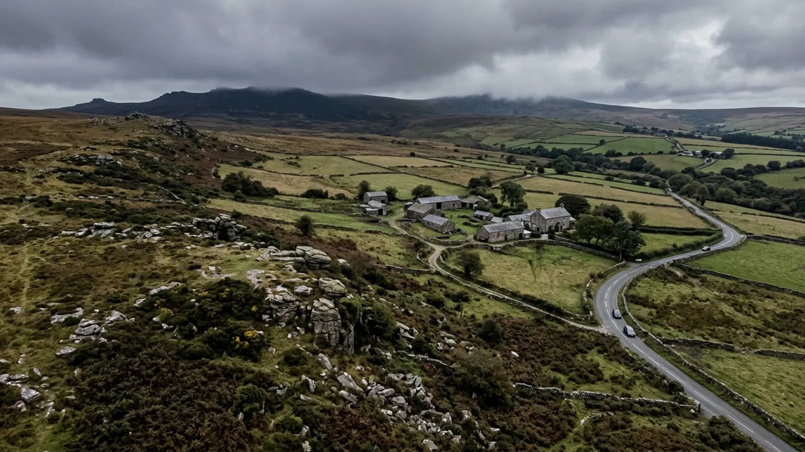
Okehampton sits at the northern foot of Dartmoor where the East and West Okement meet, with the high moor and Yes Tor rising immediately to the south. It is about forty minutes from Exeter on the A30 and, weather aside, an easy town to work in.
The weather is not an aside though. Dartmoor forces Atlantic air upwards right on the doorstep, so rainfall is high, driving rain is frequent, and roofs stay wet for long periods. This is one of the wettest and windiest towns in the coverage and the survey work reflects it.
What constant wet does to a roof
Prolonged saturation is a different failure mechanism from storm damage and it produces different findings. Slate that never dries out delaminates from the tail upwards. Mortar bedding at ridge and verge loses its bond gradually rather than in a single event. Timber under a covering stays at a moisture content where rot is possible for months at a time. Organic growth establishes thickly and then holds yet more water against the covering.
The practical upshot for a survey here is that the findings tend to be systemic rather than local. Where a Dawlish roof has three tiles missing from one gale, an Okehampton roof has an even deterioration across every north facing slope. That changes the conversation from repair to planning, and it is worth having the photographic evidence when making that case to a client, a trustee or an insurer.
Granite bedded ridges are a local detail worth knowing. They are heavy, they last, and when the bedding does fail the units are substantial enough to be a real hazard, so they are photographed closely as a matter of course.
The town and the farms around it
The centre is granite and slate, with Victorian terraces and a large stock of post-war housing behind it. Beyond the town the parishes carry scattered moorland farms and longhouses, and those generate a different sort of enquiry: corrugated metal on farm buildings, long low ranges, and roofs that nobody has been on in twenty years.
Corrugated sheet reads well from the air. Corrosion at the fixings, sheets that have worked loose at the laps, translucent panels that have gone brittle, and the state of the ridge capping are all visible in a single pass. For a farm with several buildings, one flight covers the lot and gives an order of priority.
Longhouses and moorland farmhouses are the more interesting case: old, often listed, frequently altered, and standing in fully exposed positions with nothing between them and the moor.
Flying on the moor edge
Weather on the moor edge changes fast and it changes locally. A clear morning in Exeter means very little about what is happening at the foot of Yes Tor forty minutes later, so flights here are planned with the local forecast and with a willingness to abandon.
Open ground and high terrain also affect the radio link and the visual line of sight, both of which are planned around conservatively. Meldon Viaduct, the castle and the National Park boundary are the local landmarks, and the Park itself is treated with the care any protected landscape deserves when planning where an aircraft goes.
Behind the survey
What Okehampton clients are actually buying
Registered with the CAA
A registered operator with both an Operator ID and a Flyer ID. The Operator ID is the one that has to be displayed on the aircraft, and it is the number a client or an insurer asks for.
A2 Certificate of Competency
The A2 CofC is the theory and self-practical qualification that sits above the basic Flyer ID test. There is no GVC, which is stated here rather than left out, because it changes how some sites have to be planned.
Insured with Coverdrone
Commercial cover through Coverdrone, one of the specialist drone insurers. A copy of the certificate goes out on request before a booking, not after it.
DJI Mavic 4 Pro
The main survey aircraft. A 100 megapixel Hasselblad camera and 6K video, which is what lets a photograph of a ridge from twenty metres away still show an open mortar joint.
DJI Mavic 2 Enterprise Advanced
The thermal aircraft. A 640 by 512 radiometric thermal camera alongside the visual one, so a heat pattern can be read against the picture of the same elevation.
Construction background
The surveying came after years of contracting, so the report is written by somebody who has stood on the scaffold as well as flown over it, and who knows which faults matter and which are cosmetic.
Written report within 48 hours
A process commitment, not a sales promise. The flight is the short part of the job; the report is where the time goes, and it lands within two days of the visit.
No scaffolding, no ladders
Nothing leans on the building and nobody goes up it. That removes the access cost, the permit paperwork and the working-at-height risk from the survey itself.
Nearby
Also covered around Okehampton
- TavistockAbout an hour from Exeter. A Victorian planned town in green Hurdwick stone, very wet, with tall stone stacks that take real wind loading.
- CreditonFifteen minutes from Exeter. Cob and thatch in the lanes, Devon slate and stone tile in the town, and a valley that is hard on thatch ridges.
- ExeterThe base town, ten minutes away. The constraint in Exeter is other people rather than distance: dense roofscapes, student blocks, city airspace.
See the credentials
Talk to a surveyor in Okehampton
Send the address and what is worrying you. Sam Hembury will come back with a fixed price and the next slot that suits the weather.